|
|
3rd October 2015. Pack and away and straight
down 95, the jink on 10 and then across to 75 and home. A straight shot on freeways (mostly) and as we went further
South the weather improved steadily and was pleasant enough for Florida on arrival. Home by 1730 and unloading for a
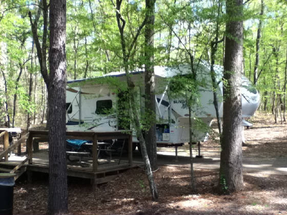
while. The trip was 4 months and 4 days, 16,000 miles almost exactly, 21 US states, and 5 Canadian provinces.
The Bay of Fundy and the Maritime Provinces were the highlight. And now we get to catch up on all the paperwork and
administration that was waiting, and back into the home routine. A very enjoyable four months.
2nd October 2015. Truckie got his oil change in the
morning before departure back to Savannah, via the Southern route. More of the same country, and Tennessee still seems
the most appealing. And then to Pearl's Seawater Grill for the She Crab Soup and a most excellent dinner. This
was the fourth of the restaurants we wanted to revisit on this trip, and each has lived up to expectations. The rain
had set in (this system subsequently led to the extreme flooding in South Carolina) and we went to sleep to the sound of rain
on Mandy's roof - very soothing - except when you had to take Dog out for a snake's hiss. 1st October 2015. We left Mandy behind and drove
up to Aiken to look at the countryside. Very flat, very riparian, and not that attractive. The area to the North
and West was a little better, but still scrubby. Aiken is larger than we thought, and almost a suburb of Augusta.
We spent the night in a motel, with Dog. The Outback Steakhouse provided two eggs on my steak without a murmur.
Most sophisticated.
30th September 2015. Under way by 0900 local for the initial run down I-10 to Tallahassee. The weather was particularly humid with dew everywhere while packing up. The GPS did a recalculation as we turned North and we ended up trying to go back before setting her right for the original route. North-East across Georgia through Valdosta and into rain that was heavy at times. The trip was 7:30 hours and we were glad to get into the KOA about 20 miles South of Savannah, just off I-95. 29th September 2015. Shopping in the morning and then in to Pensacola in the afternoon to see Travis and have dinner with him. Good meal at Landry's. The weather has improved but remains overcast. 28th September 2015. From Pine Mountain to Pensacola - Milton really. Rain. This is the second time we have come in this back way to Milton. Travis came to visit and for dinner. 27th September 2015. From Fort Mountain to Pine Mountain in rain. Dinner at Cricket's. The bread pudding was as good as ever and we took three "to go". This was the third of the four restaurants we wanted to revisit on the trip. Best dessert in the US. 26th September 2015. After another night of rain/mist/fog we headed out to look at the countryside to the South-East, looping back to the West of 411 and arriving home in rain /mist/fog about 1830. A strange mixture of awful and excellent homes, but a lot of wooded hills between. We stopped near Jasper to shop and get an Internet connection at Walmart. They really are everywhere. 25th September 2015. After a night of rain that started about 2230, and was heavy at times, we meandered East as far as Dahlonega where we shopped and accessed the Internet before turning for home. The land was mostly mountain forest. A severe accident held us up for about 30 or 40 minutes, so the trip on 52 through the mountains ended up in cloud and almost dark as we arrived back and the rain set in again. 24th September 2015. We came down from Morrisville on mostly back roads and 411. The roads varied greatly between mountain twisties and four lane highways. The country South and East of Morrisville looked quite pretty. We got into Fort Mountain State Park just East of Chatsworth and seven miles up the mountain. Nice place and a good but tight camp site. Rain forecast starting tonight. 23rd September 2015. We spent the day making the trek to a very remote house Diane had seen for sale. Getting there was quite an adventure looping out to the West of Morristown and ending up on gravel back roads and finally arriving at a dead end (after being led on by the GPS for a while before she coyly demanded a u-turn) where the house was. As it turned out an agent was showing it to another couple, so after them we got the tour. Too large, too remote and too much initial maintenance required. We looped out to the South passing through the outskirts of Knoxville and home to Panther Creek after buying stink bug trap components. 22nd September 2015. After just the one night (and sewerage) we took a straight shot down 81 to Panther Creek State Park near Morristown, Tennessee. A very pretty and well set up park we really liked. Comme d'habitude we did our shopping at Walmart and returned to find the attack of the stink bugs. We had picked up a couple before and thought we were now far enough South, but not so. Plans for a stink bug trap were sought. 21st September 2015. Headed out in fog and down the Skyline and across to 81 and then Roanoke where we had Mandy's left wheel bearings checked. Brakes not binding, wheel play nominal and some more grease pumped into both. No problem found but peace of mind restored. Again, Camping World did good work, after you got through their poor administration. On to the KOA at Wytheville and I went into town to shop and get a replacement bulb for Truckie's right low beam, and fitted it when I got back. I noted Mr Huff had both the Ford and GMC dealerships on the main drag in town, and the latter had a traffic light dedicated to getting in and out of it: I conclude Mr Huff has some influence. 20th September 2015. Ben and Kate were gone by 1000 and we had another quiet day. Colder. 19th September 2015. In camp at Big Meadows
with Ben & Kate around a better and less smoky fire.
18th September 2015. With Ben & Kate we retraced our steps up to Big Meadows Campground, in the afternoon. There is no mistaking the crash of a bear trap being sprung. The juvenile that had become too familiar with campers and their food had been caught and later in the evening, trap and all, he was carried off. The tent campers nearby were happy, after seeking reassurance that he was in fact the troublesome one. Cold evening around a very smoky camp fire. 17th September 2015. We left Mandy at camp and drove the somewhat tortuous descent across to see Kate & Ben in their new home outside Washington DC. A lovely large home in a great area. Three dogs in the house was "interesting". We went out to dinner and stayed the night. 16th September 2015. A straight shot South on multiple interstate freeways to Front Royal, and then down the valley and up onto the Skyline Drive to Big Meadows Campground in the Shanendoah National Park. We had been here before in 2012 when Diane et al had walked this portion of the AT and Dog and I had been supporting them in Mandy. The fridge has become moody, sometimes working, and sometimes not when on gas. There is a bear trap nearby, there being one regularly prowling the area and becoming a worry. The left rear wheel bearing was very hot, on arrival, and will need to be looked at. 15th September 2015. Having heard about them from two gentlemen in bowler hats at Tatamagouche, I drove across the border to Beau Chapeau in Niagara-on-the-Lake, Canada. Customs were quick and they opened the store for me early and I bought two hats, that actually fitted. Back into the US and Customs were cursory - I presume they could see I'd been across for only an hour and a half. Many vineyards on that side of the border. We packed and were off by 11:20. A longer harder day that expected. Secondary roads cutting back and forth and through a couple of 2000' climbs for 5 hours plus till the KOA at Bellefonte. Both upstate New York and Pennsylvania countryside were very pretty. The leaves are turning, the geese are heading South, and so are we.
14th September 2015. A sunny day after the low moved away last night. We went to Lockport, about 20 miles, to have Truckie's oil changed. That's 12,000 miles down. We then took a trip to inspect the locks for the Erie Canal there and the bike path. The lady at the visitor's centre said the bike tour starts exactly there, so it was good to see it. We watched a tourist boat lock through and I have to rate these the fastest locks I have seen. It is now a flight of two modern ones replacing the original flight of five. Money from the bank, vegetables from a roadside stand and then the required pilgrimage to Niagara Falls. The road approach is complex, the parking hard to find (and to fit Truckie into) and the tourist nature of the place overwhelming. The view of American Falls is quite good, but you really don't get to see much of Horseshoe Falls. The rapids upstream of the falls are significant and the turbulence of the water below as well. Perhaps the view is better from the Canadian side. While impressive, we were a little disappointed by the access, views, and the way that they are presented.
13th September 2015. The rain had eased but it was still a bit wet packing up. There was light to moderate rain on and off all day as we came down out of the Adirondacks and onto the freeway (not so free, a $27 toll) through to Buffalo, and then North to Youngstown and the State Park at Four Mile Creek on the southern shore of Lake Ontario. We set up in rain, and then it really came down, with associated strong winds. You could hear the waves crashing on the shore and it would have been miserable out on the lake. 12th September 2015. The rain started late in
the morning. We stayed in camp and then in the afternoon checked out the restaurants in town, and did some shopping.
In cold wet conditions we went back to town for a very good steak dinner and rushed back to Mandy and the heater. It
seems there were bears about overnight and next morning. We slept on and saw nothing. The RV had rocked during
the night with associated grunts and growls but I presumed it was Dog. Maybe it was, but then again, maybe it wasn't.
11th September 2015. Another 6 hour day.
It rained on and off all night but had cleared by the time we had to pack up. Just past Plainfield an adolescent black
bear loped across the road about a fifty yards ahead of us and disappeared into someone's cornfield. The GPS showed
some quirks as she took us on back roads after crossing Lake Champlain into New York state. We crossed the Hudson River
and then wound our way through the woods (very pretty) of the Adirondacks. One short cut she advised started to look
a bit rugged so we backtracked, and then got caught up in a street fair somewhere that required a detour to allow a u-turn
to allow us to backtrack to the detour around it via an horrible back street of wherever town this was. Nice country
but many abandoned buildings. Apart from tourism, one wonders what supports the area. Glad to get into camp and
set up in pleasant weather.
10th September 2015. Back into Plainfield in the afternoon
for minor shopping, Internet access, and a walk around Goddard in light rain. Nice to see where Diane did her degree
- very pretty. Looking at the notice boards, books and courses I realized just how left wing most colleges tend to be.
The presence of one full board dedicated to the United Auto Workers union left me wondering what it's relevance to a college
might be. Back to camp, and the rain continued. 9th September 2015. We ambled off just before noon for the 2 hours to New Discovery State Park near Marshfield Vermont. A variable road but good scenery and you can see why people come to the area. The economy seems well down, however, if the closed commercial properties are any indication. We went into Plainfield after setting up where we checked out Diane's Goddard College, and used the cell service to check mail. The predicted weather loomed and we scurried back to camp just as the heavy rain and thunder started.
8th September 2015. As required, we took Truckie,
or rather Truckie took us to the top of Mt Washington. It is a privately run Auto-Road and they do a good job.
The road is good, but care has to taken when passing since there is no shoulder, no guard rails, and a precipitous drop if
you get it wrong. Out on top there was mostly cloud but enough of a view to be impressed. There were a number
of AT through hikers at the summit and Diane exchanged stories with them. The consensus was that she had done the best
bit. We saw Tip-Top house and the museum. The dots on a map showing where people had died were a reminder of the
severe and changeable weather up there. A day well spent. 7th September 2015. It ended up as a six and a half hour day from Houlton, Maine, to Dolly Copp Campground at the base of Mt Washington in New Hampshire. The GPS took us the faster but longer way. The roads varied from great to awe inspiringly bad. The temperature got up to 90, but is didn't feel like it when we got out to refuel in Augusta, where we turned off I95. Many small towns, verging on villages, with the occasional area of agriculture - pasture or corn. There were a number of lakes.
6th September 2015. We sat in camp with a late run into town for some more groceries, since we expect to be a little remote for the next few days. Warm. Barbequed snorkas for dinner. 5th September 2015. We were sorry to leave Nova
Scotia, but nonetheless backtracked West to and then through New Brunswick and via Moncton and Fredericton to the US border,
through a somewhat brusque customs (although they let us bring in the case of wine duty free), and then a short distance up
the track to Houlton, Maine where we made camp at the very pretty, privately owned My Brother's Place campground. I
shot into town for supplies and then demolished the remaining dozen oysters that had kept perfectly on ice in the cooler.
4th September 2015. We set out late in the morning
for Wallace and then Malagash where I sampled the oysters. Excellent. We immediately set out for the hardware
store in Tatamagouche to buy an oyster knife, and leather gloves and check out the restaurants. On the way back to the
oyster place we made the required stop at the Jost winery so Diane could buy a case, and then returned to purchase a dozen
and a half oysters. We got on well with the owner and his wife with sailing, flying and oysters in common. He
explained how the ocean was steadily eroding the shore: the bank he now harvests oysters from was where his great grandfather
used to graze cattle in amongst trees. For dinner we returned to The Train Station in Tatamagouche. An excellent
meal in a converted railway car. You can even stay there in converted baggage vans. Trains and seafood and wine.
It doesn't get any better and was a fitting last evening in Nova Scotia. We liked the Pugwash to Tatamagouche area a
lot.
3rd September 2015. We made the trip North to Pugwash where we camped at Gulf Shores, with a wonderful view over the sea facing PEI away in the distance. A weak cold front went through in the morning and the cool to cold north wind off the Northumberland Strait was great. Yesterday we saw geese heading South, this morning a number of red leaves started to fall from the trees, and this evening it is going down to 49 they say. Autumn is approaching.
2nd September 2015. We made the hour trip up to the mouth of the Shubenacadie River to go with RiverRunners in inflatables, to experience the tidal bore there. By 13:30 we were sitting on a sandbar waiting. Initially you just see where the incoming wave is breaking along the shore on either side, but as the river narrows and shoals it starts to break right across. We slipped onto the back of the bore and followed it for a while as it grew. We then surfed around the side, in deeper water, ran out ahead of it and then powered back through the centre of it. By this stage it is about 4 feet high and breaking continuously. We got very wet. We landed on a sandbar and got a feel for the speed of the incoming tide (15 kts at a guess) and the force of it. A countercurrent was enough to lurch you to one side, even though standin in only 1 foot of water. We continued upstream behind the bore, where standing waves were starting to appear and continued to grow. The boat driver took us sweeping down river (making slow work against the incoming tide) and then through the waves again and again. She said they were 12 feet but I reckon maybe 5 or 6. But enough to make the inflatable bounce and retaining ones grip difficult. After two very wet and active hours we returned for a shower and back home to Mandy. I now have an intimate acquaintance with the Bay of Fundy tidal bore. 1st September 2015. In the afternoon we made the obligitory trip to Peggy's Cove. Very picturesque with the little fishing village, iconic lighthouse, and barren, glacier scraped rocks. I also took a look at the Swissair 111 memorial. The plane went down, after a cockpit fire, just 8 miles off the Cove. Shopping (we bought a lot of chocolate) and home. 31st August 2015. I went into Halifax to visit the
Maritime Museum. I spent an hour there, and then toured HMCS Sackville, the last corvette in existence, for a couple
of hours. There was access almost everywhere, up and down ladders that elsewhere I suspect insurance companies would
prohibit. Not much fun to man such a very cramped and underpowered ship in the North Atlantic, but fascinating, and
now, unique. About 60 years ago I had read an article on the 1917 Halifax explosion and today got the details and inside
story. The anchor stock of the Mont Blanc was found 5.5 km away (the largest piece recovered) and the blast went down
to the bed rock, emptying the Narrows completely for some seconds. About 5k of explosives went up and about 2k people
died both from the blast and the wall of water that swept the town and then retreated. I poked my nose into the Titanic
exhibit, which concentrated on the role Halifax played in recovering, identifying and burying the bodies still left in the
water. Next it was a pilgrimage to see the memorial to Sailing Master (as he was then) James Cook, RN who was stationed
here for some 7 years and learned his surveying skills. Shopping (a bottle of that excellent DOW port) and back to Mandy.
Peak hour traffic in Halifax is appalling. 30th August 2015. Four hours mostly on freeways to Sackville, just North of Halifax. Easy going (for a change), pleasant country and camp set up by 16:00. 29th August 2015. We made the short 2 hour trip backtracking
to Baddeck in order to make the leg to Halifax a little easier tomorrow. The camp ground is owned by The Red Barn so
we went there for dinner again and then attended a Ceilidh (Gaelic for "gathering") in town where a very good fiddler
kept us entertained with reels and jigs for a couple of hours. Very Irish/Scots. 28th August 2015. We went shopping in the afternoon and used the Keltic Lodge Wifi to check e-mail. Saw a whale well out to sea. After all the weather last night, today was near perfect. 27th August 2015. A pre-frontal day with slowly increasing
cloud and a moderate to strong SE wind. We drove along the Cabot Trail around the north of the island to Cheticamp and
then back. There is no other way of returning short of a complete circumnavigation of the entire island. The scenery
was spectacular in all respects, coastal, riparian, and mountain. After getting back the front arrived with a little
thunder and a lot of rain. It was the first higher latitude front I had experienced in a long time - and I loved it.
Wind, cold and rain diminishing to driven drizzle and showers. We ate at The Seagull in Ingonish (excellent Seafood
Martinique) and then went on to the Keltic Lodge where Diane had Irish coffee, I sipped an excellent port (DOW Vintage), and
we listened to a local folk singer in their opulent lounge area. Very civilized. Some Comments About Canada 6. Canadians are the best wood cutters, splitters and stackers in the world. 7. Whoever makes up the pictographs for the signs along the road that indicate
the services off each exit has been very creative. Creative
to the point of incomprehensibility. We have managed to decipher three with some certainty. One warns of jellyfish
ahead, another indicates where you can get you truck washed, and a third where you can get your truck's blood pressure taken.
Others remain mysterious. 26th August 2015. A slow getaway and what was meant
to be an easy two hour jaunt become a bit annoying due to the interminable roadworks. Even when not being worked on,
the roads were bloody awful - a veritable disgrace given the 40 cent tax on each liter of fuel. Over the Big Smoky and
into the National Park where we set up camp. The coastal scenery is good. We checked out a couple of restaurants
and the Keltic Resort before refueling and returning to camp. 25th August 2015. We drove across the island to the
western shore, and then south and east again along a gravel road of variable quality before getting back in time to shop and
refuel. The country on the way back was less wooded and more agricultural, much like PEI but not as neat. We had
a very pleasant dinner at the Red Barn some 27k up the track: the seafood chowder was excellent. 24th August 2015. Just the one night and then the
four hour trip to Whycocomagh, Cape Breton Island. This time taking the coastal road was a winner: we enjoyed the drive
greatly. Very scenic and a mixture of coast, agriculture, villages and small ports. It rained on and off overnight,
cleared around noon, set in again with drizzle and then steady rain just as soon as we set up, and then cleared. The
maritime provinces microclimates are difficult to get a handle on, but there is a low pressure area just off the coast.
This provincial park is a little more open and a little more densely populated. Never thought I'd get to see this part
of the world and very glad I am. 23rd August 2015. No fog this morning. But a
faraway fog horn on the coast could still be heard. We got away about 11:00 after dumping and taking on water on a sunny
day of about 80' and in packing up, for the first time in weeks, I was sweating. We took the highways through St John
(the falls were really roaring out) around the north of Moncton and into Nova Scotia. There seemed a little more real
agriculture here, but the roads are worse. Strangely enough we got a better view of the country on these freeways than
we did on the various "scenic" routes we had tried. Into the Amherst Shore Provincial Park and snugged down
by 15:00. The last bit of road was really bad, but then I missed one turn that would have been more direct.
22nd August 2015. We went into town about 09:30, town
being St John, and watched the outflow at the reversing falls for about half an hour. It was an hour and a half before
low and the falls sure had reversed. As we watched the rapids upstream became more turbulent as the water visibly lowered.
The downhill rush at the bridge was much more prominent than the uphill one. We had breakfast in town, checked the falls
again and then attended to administration using their wifi while drinking coffee at Starbucks. Shopping, fuel, and then
back to Mandy. No fog tonight. Perhaps frontal passage has occurred and the wind is from the NW, off the land. 21st August 2015. It rained overnight, and on and
off until lunch time. We headed West to St Stephen and looked around, passing the crossing back to Maine and the US
before going shopping. The temperature on departure was 64' with drizzle and fog. In St Stephen it was 84' with
sunny, muggy conditions. The interplay of the micro climates here is remarkable. We returned to Black Harbour
where we did some more shopping and failed to connect to their Wifi. Back to Mandy and an early dinner of chicken sandwiches.
The fog is ever lurking. 20th August 2015. In camp. I went into St John
just before noon and had Truckie's oil and filter changed. That's over 9000 miles down with changes at Sioux City, Sault
St Marie and now here. Money from the bank (legally), shopping and then a look at the Falls which were at the same stage
as we saw last time. The fog broke, just, about 13:30 and I was back at New River by three. 19th August 2015. Fog all night and all day more or
less. We caught the 13:30 ferry back to the mainland and saw nothing until we were about to berth. Retraced last
weeks steps to New River Beach Provincial Park and set up in site 92 this time. Dinner of scallops and fish from the
Gull & Herring down on the beach again. The fog, a few hundred yards in from the beach, is in abeyance. 18th August 2015. The fog was in by morning and burnt off later. We took the road to Dark Harbour (definitely dark - a narrow fiord-like rift with high wooded hills on both sides) where there appeared to be little but a jetty and some dories on boueys. Back across the island to Grand Harbour where the main yard of a wrecked square rigger lay in front of the museum. It was huge - a bloody double length telephone pole. Very large but no one knew what the ship was it came from. Back to North Head and a look in the maritime beasties museum and a talk with the curator. Salmon farming and herring to feed them and tourism are about it for the island now. The fog rolled in again early and the fog horn started up, to my satisfaction.
17th August 2015. In the morning we walked to
the lighthouse and read the notice advising us that the fog horn would damage your hearing if it started
up while you were there. Fortunately, no fog at the time. In the afternoon we went North as far as one can and
at the shore there saw multiple seals spy-bobbing. We checked out the local restaurant on the way up, and after depositing
Dog at home, returned for a most excellent meal that evening. There is not all that much to do here, but it is a great
place and very restful.
16th August
2015. We toured down to the South end of the island along the East coast. Not far and a good view with
the cliffs, lighthouse, and explanation as to why a portion of the area between Canada and the US is still the subject of
a border dispute - hence everyone fishes there and no one has juristriction. Seal Cove has massive and decrepit infrastructure
and buildings and must have been a major, major fishing port until they fished everything out. We stopped off at what
seemed to be a private home for tea and scones. More fog. 15th August 2015. A slow getaway just before noon,
and by 1240 we were lined up at Blacks Harbour for the 13:30 ferry to Grand Manan Island out in the Bay of Fundy. A
nice one and a half hour crossing. Flat calm and the only sea life were the birds. No fog, as there has
been on and off most other days. Off the ferry, up the hill, and set up in Hole in the Wall campground shortly before
four. Although there did not appear to be any fog around, the fog horn in the nearby harbour started up at dusk.
Wonderful. We will go to sleep to its sound. No, I really mean, wonderful: I love it.
14h August 2015. We went into St John and watched
the Reversing Falls where the reverse flow was in operation. Very impressive to watch the river being backed up.
To Diane's dismay, I sat and watched for three hours until slack water. What really got me was the level of the water
dropping, as indicated against a stone bridge pier, while the flow was still strongly in. You get a feel for tidal flows
by watching. We then did some shopping, and sat in Starbuck's to use their wifi to collect e-mail. Back to camp
to eat scallops and chips from th seashore cafe, the Gull & Herring, and sit and survey the exposed beach as the
tide turned.
13th August 2015. Packed up and departed for the Provincial
Park at New River Beach. Again we tried the scenic route with more or less the same result. The GPS was becoming
irritated with us as we wound our way back onto the highway and through St John via the Reversing Falls Bridge. It was
a change to be on a major highway for some of the way to the park. Nice spot and easier to back into. After arrival
there was time to reconnoiter the ferry terminal and do a little shopping in Black Harbour. 12th August 2015. It rained steadily until about 16:00. We spent the day reading.
11th August 2015. A quiet morning, and then late in the afternoon we did a short walk to some falls, and then drove back to Alma where Diane and Dog walked the exposed and extensive tidal flats, and I took photos of the empty creek and scallop trawlers high and dry. An excellent seafood meal at the local restaurant, and then we watched the tide roll in until about an hour and a half before high, by which time it was dark. So now I have seen the tides in the Bay of Fundy, something I have wanted to do since primary school days when I learned about them. It clouded over quite quickly late in the afternoon and by ten o'clock it had started to rain. 10th August 2015. After more or less continual rain overnight we packed up on a clearing morning, managed to hitch up at the odd angle we were on, and departed just after 11:00. $60 plus dollars toll on the 13 km Confederation Bridge (we are not sure who confederated, and when) but worth it. We took to the "scenic" back roads, but found them again to be just back roads, and poor to very poor ones at that. The GPS kept, ad nauseum, telling us to make a U-turn. We ploughed on up the East side of the ? River, across the head of the estuary, and then down the West side. This was our first view of the Bay of Fundy tides. It was approaching low water, between springs and neaps, and the expanse of red river bottom, and the empty red clay ravines leading to it, were impressive. We decided against another "scenic" road, but the main drag around the coast had some good vistas. We reached the Fundy National Park around four, but after we found where to get in, and then negotiated major, major road works, and then over forty minutes backed and filled into the site, it was six. A seven hour day which was meant to be four. Getting into the site was difficult because of the narrow culvert (with deep ditches either side) and the ditch on the far side of the road which meant you couldn't swing Mandy once on the culvert. We got there in the end, but it was hard work. The good news is that Diane and I remained civil to be another as I drove and she directed. We earned our evening shandy. 9th August 2015. In the afternoon we set off for a look at the south-east corner of the island and to try some of the "scenic" roads. All I can say is that these roads were bad, and definitely not scenic. We made it to Cape Bear where I climbed to the top of the lighthouse (decommissioned, but functional) and then went to the Marconi station (museum, and definitely non-functional), where the Titanic distress call was first received in 1912. Back in Charlottetown we passed what seemed to be a significant fire in the old district, shopped, bought timber for the bed, and back to Mandy in time for laundary and showers. 8th August 2015. We toured North and East and stopped off at the property that had inspired the book Anne of Green Gables and did the tour. We knew nothing of the story or history, but now know quite a lot. The country was really lovely as we looped out along the north coast, and then down the western side before cutting back to camp. The 25m above ground pool had sprung a leak and dumped its contents down the entrance road, so no swimming. We had a fair seafood dinner at The Wharf in Charlottetown. 7th August 2015. We tried to follow the coast as much as we could round to the bridge to Prince Edward Island (usually referred to, we find, as PEI or simply, The Island) which led to some interesting detours but always seemed to dump us back on the highway. The bridge crossing was impressive and we were both reminded of St Helena as we wound through extensive agriculture and small settlements. It was nice to see the extent to which large stands of forest or planted windbreaks have been left among the cultivated fields. Into the KOA campground in a nice but crowded corner spot, but the pool was knee deep in ankle biters. 6th August 2015. By phone arrangement we were at the dealer's by 10:30 and they confirmed that there was no structural/mechanical problem in the front end, just a dying tyre. It took two and a half hours to locate the replacements and then forever to do an alignment after fitting them. Seems Truckie has never had an alignment in her 89k miles, and they had to work at the adjustment fittings. By 17:15 we were under way, but road works meant we were approaching the Kouchiebougouac National Park at 18:50. Shortly before, Diane and I had speculated on the large wooden staved barrels by the front gates. She suggested that they were for milk, eggs and bread to be delivered. I suggested they were to keep bears out. She, with withering scorn, informed me "You're dreaming, there are no bears around here!" A few miles further on, there was a black bear cub rummaging around by the side of the road. I rest my case. The address, obtained from their web site was a residence, but a couple of miles down the track we entered the forest, and to reach a road closed sign and a detour back the (lengthy) way we had come. We went down the highway a couple of miles and found a sign and headed in. A camping sign intervened and we followed it, only to find it was a commercial site, and not the park. I'm getting better at U-turns now. Retraced steps again, and after blundering around the really poorly signed area ended up in the right spot, just before 20:00. A pretty spot, but with little time to enjoy it. 5th August 2015. Another day in camp. We did the same 1.5 mile beach walk in the opposite direction. When the wind gusted off the water, it was cold. It was great to be by the sea again, and walking barefoot on the beach. I refueled and did some shopping later in the day and we discovered the growing click from the front left tyre on Truckie was not an embedded stone, as I thought, but a very bald spot about 12 inches long on the inside of the tyre. Further examination revealed dry rot in both front (older) tyres, the probable cause. 4th August 2015. We had dinner in town and then wandered around Tracadie-Sheila finding it almost deserted with very little activity. No evidence of major tides here as we sought the sea down back roads. A good meal though. A far off thunderstorm late and we went to sleep to the sound of light rain. 3rd August 2015. We left the lovely camp site and made the short two and a half hour trip round to Val Comeau campground just south of Tracadie-Sheila. There were only a few views of the sea as we crossed small peninsulas through farming land. Not the Quebec characteristic coast at all. A nice site but very packed in. The saving grace is the sound of the sea nearby. We walked the beach late in the day. The water was cold. It seems today is a public holiday but seems to celebrate nothing in particular except Summer. Read up on the Acadians, and their history in the area. French is definitely the predominant language in this part of New Brunswick. 2nd August 2015. We went shopping and refueled late, arriving at shops as they closed. Limited goods. 1st August 2015. Stayed in camp. Read.
Rained from late afternoon on.
31st July 2015. We drove the scenic route to
Great Falls near the border with Maine. The country was a real surprise. I had expected unbroken forests and hills
but there were many fields of grain, and especially potatoes. This must be the potato capital of the world - sorry about
that Idaho. The downside was the prevalence of clearcut logging. There was no evidence of replanting at all, and
where there was secondary growth it was scrubby in the extreme. Disappointing to see, especially the scope. The
Grand Falls were indeed grand. During the thaw the volume through this relatively narrow gorge is, they say, nine tenths
of that over Niagara. That I would like to see. Even with only three of the ten or twelve floodgates partially
open the flow and falls we're impressive. We (including Dog of course) walked across the bridge and along a bit of the
gorge up to the falls and back, and then (without Dog of course) took the zip line across, and back. Fun, but short,
and although suspended over the turmoil of the gorge just below the falls, it seemed routine. Must be getting jaded.
We came back the long way, up the Tobique River Valley which we found very pretty (but no moose), past Mt Carleton, and then,
over bad roads back to camp at Sugarloaf. A longer day than intended.
30th July 2015. A lazy day in camp. The surrounding and over growing trees make it dark until mid-morning, and with the time change we slept until ten. In the afternoon we took the chair lift to the top of the thousand foot ski runs, and then walked down, since for some unknown reason the chair lift only worked going up. The walk was interesting for my knees. I would have preferred to walk up and take the lift down. But a thing well, if painfully, done. The major reason for the lift running at all is to take mountain bikers to the top. They seemed to enjoy the run, and jumps, to the bottom, going round again and again. 29th July 2015. A relatively quick getaway from the crowded park and a meander up the south side of the St Lawrence. Very soon the landscape became a little more Arctic looking and the pines started to thin out and become straggly. There were houses/villages evenly spread along the rocky glaciated coast, but no sign of a fishing industry and we saw only one "harbour of refuge". We turned South along 299 up the St Anne River valley and immediately the vegetation thickened and grew almost lush. We threaded our way up to the pass over the Chic-Choc Mountains (you'd have to drive through mountains with a name like that) at about 1800' and then down the Cascapedia River Valley to Chaleur Bay. The mountains (yes, real mountains) had bald tops, and I'm not sure if they are above the tree line, or just bare scraped rock - or both. Impressive river based on the rocks and trees that are piled up everywhere: it must be something else during the Spring thaw. This bay was also lined with houses and villages but looked more touristy and warmer than the north side of the peninsula. We blundered our way to the beautiful Sugarloaf Provincial Park, complete with ducks on the pond and a relatively isolated, wooded camp site. We arrived an hour early since there is a further time change, crossing as we did, just, into New Brunswick. The weather was perfect with the temperature ranging from 65' on the North to 82' in the South. We hit what I expect is our most northerly latitude at 49' 8" or thereabouts. We had dinner in the restaurant. 28th July 2015. In camp on a day where it was cloudy in the morning and sunny in the afternoon when we went for a walk round one of the trails. Really beautiful along a cleared, grassy and mowed track through the thick pine forest. There is more undergrowth than you would expect and the ground looks like it might be swampy for a part of the year. Walker was a happy dog, and intolerant of anyone stopping, except himself. But the camp sure does pack us in. 27th July 2015. Early morning rain again and
it was a bit wet underfoot as we packed up. We drove North-East along the south side of the St Lawrence, which is definitely
an estuary at this stage - very wide. It is beautiful country (again, with the caveat "in Summer"), some of
the best I've seen, with what seems to be a glaciated flood plain. The outcrops of rounded rock sit out occasionally
in among the low hills and forested areas. Grain seems to predominate, with some cattle. We found the Provincial
Park and joined the line of RVs just after two. Without a reservation, we managed to get a very tightly packed in spot.
We heard no English spoken. The park we were aiming for in far eastern Quebec is full (lucky we rang, having relied
on there just being space mid-week up until now) so we will head next down to New Brunswick. Currently at N48' 40"
and we'll get only a little further North when underway next. The weather is changeable. We had sunshine after
the rain, then a lot of fog off the waterway as we paralleled it, and then thunder and a few spots of rain in camp before
a clear cool to cold evening.
26th July 2015. In camp. Laundary, shopping
and fuel. A grey drizzly day and we are glad we did the sightseeing yesterday.
25th July 2015. We caught the shuttle into old
Quebec at 09:30, crossing the St Lawrence and winding up to la Ville Haut. From there we took a bus tour of the old
town, both haut and bas and across the Plains/Heights of Abraham, the rolling plain above the river to the West. You
hear of Wolfe "storming the Heights" and it wasn't an easy task at all. The French speaking guide was at pains
to point out that the French garrison was weak, and it took four months of constant shelling to finally subdue the town after
the 20 minute infantry battle. After walking round Ville Bas we took a boat tour East to Ile Orleans and the waterfall,
seeing the massive grain docks and the city from the river. Quebec is the native word for "narrows" - it is
not French - and you can see that it is the spot the broad estuary narrows to become a river. Today there was an eight
foot tide and we climbed up the gangway to board, and then up the gangway to disembark. The inbound tidal current at
about 2 to 3 knots had me confused as to which way the river ran for a while. The Citadel (the fort finished by the
British) is superb design, but never fired a shot in anger. Cool but sunny and a very pleasant day all round.
24th July 2015. Cool to cold with strong winds
and showers so we stayed in Mandy reading most of the day.
23rd July 2015. A shorter day than expected - I had the wrong location set as destination - but still four hours. We crossed the Ottawa and I remember remarking on the Trans-Canada Highway as we went underneath it here a year ago. We could just see the Ste Anne de Bellevue Lock - sort of. Montreal traffic is noteworthy, even though we were on the highway and skirted the island, it was severe. Once clear of the tunnel under the St Lawrence it was a lovely run, inland a little, down to Quebec City where we were camped by 1430. Pleasant day in the mid 70's but still the stream weather. We are starting to suspect that we saw the best and prettiest of Quebec from Halcyon. Although it is now lovely rolling and treed farmland, it doesn't seem to have the impact of the slow and water view.
22nd July 2015. In camp, reading most of the day. We walked down to a bayou off the river to see the cruising boats anchored there. It kept thinking about raining but didn't. North-west stream weather around a high. We got Ottawa television, although closer to Montreal, and found the news even more parochial than in the US. The ads are similarly apalling though. 21st July 2015. From Champlain Park we moved on to Voyageur Park on the Ottawa River still heading East. Another most excellent Ontario Provincial Park. The five hour trip turned into six, with the additional hour being spent waiting at roadworks for the single lane to clear alternately in each direction. Traffic is up and the country is more rural and populated, as you would expect as we followed the Ottawa for most of the day. Fuel is less of a problem now. 20th July 2015. Forty-six years since the moon landing.
How come there is no permanent base there yet? At least the rovers are still criss-crossing Mars, the Voyagers have
left the Solar System, Pluto has been visited, Titan has been landed on, the ISS is still up there and a comet has been landed
on - sort of. Still, we should be doing better. 19th July 2015. A long 7 hour day. A front went
through overnight but with just the wind and temperature change - no weather. Packed up, filled water tank, dumped and
were underway East on 17 by 10:20. The day seemed to go quickly following mostly river valleys with the railway usually
beside us. The roads through, and either side of Sudbury take the prize as the worst yet. The valleys before and
after we're very pretty with small towns throughout. I had expected more wilderness. A little after five we made
camp in the Samuel de Champlain Provincial Park on the Matawa River, a tributary of the Ottawa. Yes, that Champlain,
after whom the lake is named. We crossed back over the front so it was quite warm on arrival. 18th July 2015. Quiet day still at the KOA campground,
Sault Ste Marie. Washing, showers, fuel, shopping and dinner at a good Italian restaurant. We were struck
by the couples there who studiously avoided talking to be another, often by fixating on their cell phones or just sitting
in silence. We avoided this behavior.
17th July 2015. We headed south, leaving Mandy back
in camp. Back into the US across the International Bridge, past the Soo Locks and then on across the Mackinac
Bridge, under which we had motored on Halcyon, 11 months before. More impressive from the water, in fog though, but
impressive nonetheless. The only way across for a very long way around. We visited Harbor Springs where we had
anchored and not gone ashore previously - very twee - and then went on down to Charlevoix where we did some shopping and ate
whitefish at the pub for dinner. This is the second of the three restaurants we wish to revisit on this trip.
Sat in the park and listened to the band playing. Walker tried to turn down "C" dock where Halcyon had been
moored for a couple of weeks. We got back to Mandy just after 22:00 in light rain. The day was foggy and misty
with the sun making it out late while we were at Charlevoix. 16th July 2015. Oil and filter change and new wiper
blades in the morning. We visited the Bush Flying Museum in the afternoon. Not a single Cessna, though much else
and very interesting. One of the staff even knew and appreciated the Russian AN-2. There was a 185 on floats moored
out the front at the landing. 15th July 2015. On the road by 10:15 and we were able
to see the scenery and the lake (still Superior) today, unlike the trip inbound. A five hour day through very "Georgian
Bay" looking scenery to Sault Ste Marie. It is now all rocky hills with pines and swamps in between. We did
pass Yellow Brick Road, which appropriately enough led into a Barrick gold mining facility. At the KOA just north of
Sault Ste Marie by 15:20. It seems the Verizon phone works here. 14th July 2015. It drizzled, rained and then blew
all night. I got up at 0400 to retract the awning and was dumped on by the water that had collected on it. By
daylight the wind stayed up but things were clear and it was quite a pleasant day to contemplate the lake and the sound of
the waves. A cool to cold evening with almost no wind. I adjudged the water and air temperatures too cold to swim. 13th July 2015. A little reading reveals that despite
a proportion of the Manitoba wheat going to the west coast by rail now, the bulk makes the six day trip by lake boat from
Thunder Bay to Sorel on the St. Lawrence (half way between Montreal and Quebec City) where it is transferred to ocean going
ships for export. Only six days for Superior, Huron, Erie, Ontario and the many locks is very impressive. 12th July 2015. In camp for a day of housekeeping. 11th July 2015. We visited the very impressive (129
feet high) Falls themselves and then went into town to try and sort out the bloody Verizon phone coverage in Canada.
A forty minute phone call ended up being disconnected and seems to have achieved nothing. We have paid for Canadian
phone access but it just doesn't work. We found the marina and the commercial port, the latter being huge. There
is a massive complex of rail lines and grain silos - more train tracks side by side than I have ever seen. I presume
the Manitoba grain harvest comes in here by train and then goes out on the Lakes ships. The place must be frantic come
late Summer. I'd love to know the actual flow of the grain. Probably through the Sault Ste Marie lock into Michigan/Huron,
but then where? South to the US or north-east to the St Lawrence? Anything that can fit through the lock couldn't
go to sea, so where does it all end up, and how does it get there. There is a huge commercial flow I know nothing about.
Everyone we talk to seems to want out of Thunder Bay, but stays nevertheless. 10th July 2015. Onward to Thunder Bay in the north-western
corner of Lake Superior. More of the Arctic looking countryside with more hills, swamps and stands of pine. The
navigation through the area in the early days would have been from lake or river to the next lake or river. The portages
would not have been long, but bashing through this country on foot would not have been fun. We turned off 17 too soon
and so after refueling in town backtracked to the campground at Kakabeka Falls. 9th July 2015. Sand Bar Provincial Park for the night.
We are now heading east and the agricultural plains have given way to lakes and swamps and scraggly pines with hills and rocky
outcrops. Very little in the way of crops but a lot of lake side tourist/fishing lodges. 8th July 2015. Straight north to a campground just
south of Winnipeg. Customs kept asking about guns, saying Floridians always had them, but in the end decided we were
all right. Fuel is thin on the ground up here and we took on more wherever we could find it. Very flat with wheat
more than corn now. We arrived early and spent the rest of the day shopping and taking a look at Winnipeg. Very
flat, with the two rivers meeting in the centre. Not terribly attractive but they have had the sense to put in a ring
road before it was needed and development is taking place along it. The trek through the downtown area turned into a
major traffic jam. There seems to be a huge abandoned military base in the middle of suburbia for some reason. 6th - 7th July 2015. Off again north, and then west
to Icelandic State Park just south of the Canadian border. Nice spot and we stayed an extra day to learn a little of
the area history and take the back roads tour through the gorge. The effect of glaciers is everywhere and the way the
gorge is cut suggests the collapse of a terminal moraine dam when the Ice Age ended. 4th - 5th July 2015. We stayed with friends for the
weekend just outside Jamestown, and learned a little of the economics of farming. The actual agronomy seemed an afterthought
once the elevator operator, government, tax and financial aspects had been considered. 3rd July 2015. We headed west out of the hills of
Minnesota and eastern North Dakota onto the flat plains covered in corn, wheat and soy. We went through the outskirts
of Fargo, a place I thought I would never get to, and then a straight shot to Jamestown, central North Dakota. 30th June - 2nd July 2015. By Lake Itasca. We visited the source of the Mississippi, refueled, rented a canoe and paddled North to the source again, but this time by water, and swam in the lake - again half a mile, the water being quite warm(ish).
29th June 2015. On the road by 10:50 after filling
with water and emptying everything else. We took the scenic route north along the shore and then across to Duluth.
It looked a bit industrial with ships and docks and smoke and trains and did not look like a good place to spend a winter.
Then a straight run west across Minnesota to Lake Itasca, the source of the Mississippi, where we camped in the Itasca State
Park in a nice spot. The weather has been great with days in the high seventies and lows in the mid fifties, although
there were some thunderstorms today as a low meandered by just to the North. Good sleeping weather.
24th - 28th June 2015. We stayed in this great spot overlookng the lake. Two trips to Ashland for shopping and administration, a swim in Lake Superior (half mile, but cold below the surface layer), dinner out (excellent), attended Sea Shanties performance at The Big Top, and took the ferry over to Madeline Island where we walked and circumnavigated in Truckie. 23rd June 2015. While walking Dog, Diane found a much better camp site on a bluff overlooking the lake. Despite the trouble getting level in the first one, and the need to back 100 yards down a winding track in between trees to the second, we did it. The backing circus notwithstanding (not too bad actually but it took a while and much maneovre) it is a nicer spot and in the wind we can hear the waves on the rocks. And the view out the windows is wonderful. We will stay for a week.
22nd June 2015. A short one hour run to Washburn in the north-west of Wisconsin and on the shore of Lake Superior. The city campground is nice and on the shore. The recommended site, large enough to accommodate Mandy, needed some serious athwartships leveling and it took some time, working forward and then in reverse as we tried various block combinations. You can see the result below. The clearings between the heavily wooded areas on the way up look like alpine meadows more than anythng else.
21st June 2015. About a 4.5 hour trip north to
Heywood and a commercial campground where we could refill water and flush the holding tank. The first part was along
the west bank of the Mississippi until we crossed over into Wisconsin and the terrain (and the terrams too) became hillier
and more wooded. We knew we were well north when we came across snowmobiles for sale on the road, and multiple snowmobile
crossing signs. Blind panic set in when we found the bumpy roads had deposited our only coffee making French press on
the floor in pieces. I immediately raced out to Walmart, just 2 miles up the road and bought two replacements.
We don't want that kind of shock again. It rained overnight but stopped in the morning for the late getaway about
11:30. I am having trouble predicting the weather here and find it disquieting. The lows that give rise to the
fronts are at our latitude and things can change without any apparent synoptic reason. Blobs of rain come through, unheralded
and seemingly at random. Quite odd.
19th - 20th June 2015. Yesterday we went to McGregor and spent over an hour watching Lock 10 on the Upper Mississippi in operation. Quite odd that we gravitated there and enjoyed it, given the 147 locks we saw from the inside last year. But enjoy it we did. The river was being well used by pontoon and other small craft on a perfect day. Went into Prairie-du-Chien to shop and refuel. Today, the 20th, it has rained most of the day with storms around though they seem to have cleared now. We finally got out of bed at 10:00 due to the cloud and tree cover keeping it dark. Dog has been well walked both days and has been in fine "voice". 18th June 2015. There is not too much to say about the journey across all of Iowa, except "flat" and "corn". Again, as in Nebraska the North-East became rolling hills with more trees than we had seen for a while. But still they squeeze the corn fields in. We got about the last spot in Pike's Peak Sate Park high on a bluff overlooking the Mississippi. It is named after the same Zebulon Pike who later explored the 14,000 footer in Colorado we went up earlier. We had some altercations with the GPS but got here in the end via secondary and much more scenic roads. 16th - 17th June 2015. We stayed over for two days, doing shopping and looking around. We visited Sioux City Airport where they managed to land (sort of) the DC10 without any controls. There should have been a memorial to the skill of the pilots, but I doubt they wanted to advertise a crash at the airport. Runway 22 is now gone, and you need to look on Google Earth to see its ghostly outline. 15th June 2015. Made the trek across the rest of Nebraska to the Ponca State Park, on the other side of the Missouri River from Sioux City. Another lovely place to stay. We opted for the shaded area rather than the open bank of the river. Quiet. The initial run was along the north side of the Platte River, after which we turned North-East through the constant corn fields and up into the rolling hills. There surely is a lot of corn. 14th June 2015. A quiet day in Gothenburg, Nebraska. I repaired the electrical connection from Truckie to Mandy, filled the water tank, and then we went to inspect the pioneer sod built house, and the Pony Express depot. Most interesting. Filled Truckie and reprovisioned. Nice town. 13th June 2015. Made what turned out to be a longer than expected day from 8,600 to 2,600 feet down the mountains, across Colorado and into Nebraska. We ended up in Gothenburg just east of North Platte, arriving at 1830 after an 1100 departure - we lost an hour as we crossed back into the Central Time Zone. Camped in a very pretty little RV park and intend to stay over a day. 11th - 12th June 2015. Stayed at Rocky Mountain National Park. We made a trip to the highest point (accessible by car) at 12,200 feet. Very impressive, and looking a bit like the Antarctic, all black rock and white snow. We ate one evening at the Rock Inn in Estes Park. Same as four years ago - the best steak I have ever had.
10th June 2015. We made the short 2.5 hour run
north through Estes Park to the Rocky Mountains National Park at 8,600 feet, where we stayed in the Glacier Basin Campground.
Remarkable views from our windows.
5th - 9th June 2015. We stayed five days in Monument
during which time we took the cog railway up Pike's Peak to 14,110 feet and went on the Royal Gorge train for dinner
and most spectacular views. The engineering, in both cases, was remarkable.
4th June 2015. An even shorter run west to Monument, Colorado where we are now staying with friends. We even have water and electricity. The temperature dropped from 82 to 54 when we went through a thunderstorm. There was torrential rain and hail all over the road around Elizabeth, but it was quite short lived. We are now at 7200 feet. We hardly noticed the rise, but Trucky did: we had to manually change down periodically on 86 across to 25. 3rd June 2015. Another slow departure and easy run to WaKeeney, Kansas at the KOA. Easy if you discount the 6 hours, and fair to moderate roads. These were the best so far and they are doing a heap of repairs and construction on them. This makes for slower travel but they are doing something about things, which puts them ahead of the other states we've been through. Exit 60 off IS135 was closed, and we blundered our way through Macpherson trying to get to the Loves service station to refuel. In the end, we gave up but had to turn East on 70 to get petrol, and then turn West again. Just as well we did as the next gas station was a long way up. A flat plain, but very green and lush after the rain. A storm threatened, and after lying in bed listening to the rain, we decided that being in a trailer park, if a tornado showed up, we were basically stuffed. There was no where to run in time. 2nd June 2015. Onward to Independence Kansas
via Oklahoma. More shitty roads but a great campsite by the lake. This was only a 5.5 hour day with a leisurely
get away. The lake is very, very high with half the sites under water, and the main road into the state park completely
covered. We found the other way in eventually. We had been there before on our way back from the West and it was
as good as we remembered.
1st June 2015. It was a long
day of about 7.5 hours through Alabama, Mississippi, Tennessee (briefly) and then into Arkansas. We gave our regards
to the Tenn-Tom Waterway as we crossed it having been there with Halcyon just a few months before. Stopped at the
KOA campground near Little Rock. The roads were uniformly frightful, and you really do despair as to the infrastructure
of the US. And these were all interstate highways!
31st May 2015. It was a relatively short 2.5 hour trip up to Montomery, Alabama where we stayed with friends on their property. The track in had overhanging trees and Diane had to crouch on the roof deflecting them, and making sure we would fit underneath. It rained heavily during the evening but the location was great and we were very snug. Sorry about the blow by blow description, but we have found it useful to have it all recorded and available for later reference - so there. 30th May 2015. We spent the day with Trav (and playing his drum set). Dog got to socialize at the Bay View dog park. Trav and I managed to persuade Diane to eat at Waffle House, about which she doesn't want us to speak. 29th May 2015. We finally got Mandy back home
late morning yesterday, six days later than promised, and spent a very busy afternoon and some of the night getting the sofa
bed back in and moving provisions and gear on board. Sorry about the nautical terms, but it still seems right.
We departed, complete with Dog about 1100 and arrived in Pensacola towards 1800 after an uneventful trip up 19 and along 10.
We have remembered well the set up procedure and everything seems to work except the CD player. Trav came to visit.
24th May 2015. Mandy is off at Camping World
being serviced and checked, and all being well we plan to depart for Canada via Colorado next Thursday, 28th. The broad
plan is to head North-East from Colorado, leave the Great Lakes to starboard, and then explore Quebec and the Maritime Provinces
of Canada before returning home down the East coast.
|