|
|
|
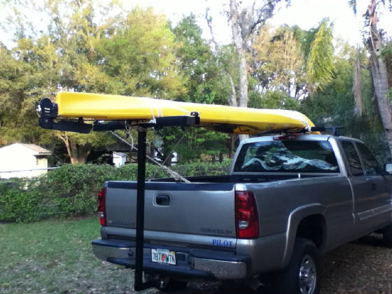
| Kayak on Truckie |
6th November 2012. Day 12. 12.5 miles.
The sky was quite clear when I went to bed at 20:30 but at 05:00 there was the patter of light rain on the tent. This
increased to moderate rain, with thunder, and given the forecast for weather with the front, I got up at 06:25. It rained
while I broke camp in the dark, and packed everything into Gretel while the no-see-ums continued to feast on me.
The tide was high, but had not yet turned and by 07:30 I was paddling in light rain against a slight residual flood tide.
With the overcast and rain it was just light enough to see where I was going at this hour. It turned cold with low scud
but no squall line, so the front must have been through. It was almost primordial ghosting along with the sound of the
rain dripping off the trees into the areas of swamp. It cleared a little and paddling under the oilskin in the sun became
a sweaty activity. About 09:30 the current turned and I made good time. After consultation with the GPS,
and waiting till I was very close I found the right creek entrance and paddled to the Suwannee Marina and pulled up on their
boat ramp and went to the shop (in my full sartorial elegance) and obtained directions to Anderson Landing. On
entry to the creek you turn left at the sign to Bill's Fish Camp, and then right just before the end of that canal and then
follow it up to the very end where the ramp (Anderson Landing) is on the left. I arrived at the landing at 11:00 after
avoiding falling in getting out, in, and then out again. I hauled Gretel out and packed everything into two parabags after
changing into more suitable clothing. The no-see-ums were even worse and while waiting for my ride I retreated
to the floating dock out on the water where things were better. I was ready to go by 11:45 but had to wait till 12:45
before Steve's girlfriend arrived to take me back to Live Oak and the truck. So that was 240 miles in 12 days, which
is about what I planned on. I am ambivalent about finishing. It is nice to get back to the creature comforts,
but it was also very nice out on the river, on my own, and camping on the bank. It was hard work (of course) but enormously
pleasant. I enjoyed myself.
The river at White Springs was 51.8 at the end of the trip,
a fall of 1 foot over the 12 days. Another foot or so in height would have made some of the rock bars easier, and given
a little more current. I lost 9 pounds in weight over the 12 days, which I could afford to lose. It came back
on very quickly, however.
5th November 2012. Day 11. 18.8 miles.
I was awake and packed and ready to go, without breakfast, just before first light. A magnificent morning to paddle
away in the light fog after launching and boarding Gretel without incident. I had worried about boarding again all night
and this no doubt helped. I went to the effort, however, of checking where I would be able to climb out of the water
if I were to fall in, and left all the unattached gear on the dock until after I was settled in the kayak. I paddled
away into the rising sun with a light following breeze on a clear day. There is a front due this evening. I was
underway at 08:15 and at Fowler's Bluff early, by 14:00. Last night I rang The Canoe Outpost for a 13:00 pick up in
Suwannee tomorrow, and checked with the restaurant at Fowler's Bluff that it was easy to find, open, and that I could camp
in their backyard. For $7 I was allowed to set up my tent, after having a cup of coffee in the restaurant.
The no-see-ums were terrible and I was copiously bitten while unloading and setting up. For the first time I had
to consider tide, and haul Gretel well out of the water, padlocked, of course. I blithely have arranged the pickup tomorrow
for Anderson Landing but am not entirely sure where exactly it is, and the staff here don't know either. I will
have to ask questions on arrival. Dinner as the only guest in the restaurant, and the lady made bacon and eggs for me.
A long chat to the owner, Lee Brian, about the history of the place, and its treasure before retiring to the tent. Today
was a good day.
4th November 2012. Day 10. 19.1 miles.
River traffic again today, for a Sunday, was light. The mosquitoes this morning were not too bad, but this being a public
park, there were two noisy invasions of revellers during the night. Firstly a horde of kids and later a mob of hoons.
I didn't bother to look at the time. Very humid and the tent was put away dripping wet. I set off into the fog
and made about 3 knots. I am used to the GPS underreading by four or five percent, I presume because I am cutting to
the inside of the bends, but in this case I arrived almost exactly on cue - not sure why. There was no wind early
but again, the sea breeze kicked in to give some headwind sections, and I was ready to stop a little before I actually could.
I got away at 09:00 and arrived at the Suwannee Gables Motel dock in Fanning Springs at 15:00. There was the challenge
of getting out of a kayak up onto a dock, albeit a floating but somewhat dilapidated one. This had to be addressed
most carefully, and I am not looking forward to having to get in down off the dock tomorrow. Today was moderately pleasant
and moderately hard but I am in a motel again with a shower, TV, and Gretel hauled up onto the dock and padlocked. Aiming
for Fowler's Bluff tomorrow, and on my reading, the tide looks good although neaps, with its effects felt upstream from there.
The motel owner ferried me to a restaurant for an excellent seafood dinnner. The restaurant across from the motel
has closed. In fact the effects of a bad economy can be seen in every town I saw along the river.
3rd November 2012. Day 9. 20.6
miles. I made it to Gornto Springs State (or County, or whatever) Park, and was forced to make camp very
quickly so that I could cower inside the tent out of the clouds of no-see-ums and mosquitoes. Fortunately, after the
sun went down, they abated and I could cook and eat. I had an awful sausage and egg thing and orange juice for
breakfast, and ate them in my motel room before partially loading Gretel, wheeling her out of her room onto the street,
putting the rest of my gear on my back, and making the trek back to the boat ramp. The wheels fell off twice.
There was quite a lot of fog and I was on the river by 08:45 and couldn't see all that much. It was very pleasant, however,
silently slipping through the gloom until it dissipated. There was no wind and moderate current as I passed the Santa
Fe river confluence, turned the corner and just paddled on. There were no snags or bars: this is the
later portion of the river. I reached camp at 14:45 - quite early but with 55 miles to go and Fanning Springs ahead
the camps space out nicely from here. The water is non-potable according to the signs, and having washed in it
(no showers) I believe it. I have enough for another day or so, however. The river traffic on the river for a
Saturday was very light and invariably polite.
2nd November 2012. Day 8. 19.3 miles. Another cold night
and after breakfast, the other occupant of the camp helped me get Gretel back in the water (unsolicited - I think he got up
to help me) and underway at 08:50. The river had gone down three inches overnight. It was difficult to read the
river and see where the snags were because of the mist, which rose from the surface in the most magnificent mini tornadoes,
each about seven or eight feet high, perfectly formed, spaced evenly about ten yards apart. There were hundreds
and hundreds of them and they covered almost all of the river. I have not seen anything like it before. There
was a fair current and a very light wind from astern. I pushed it along a bit until noon, because I was not
sure if I could get accommodation in Branford, and arrived there about 14:10. As it turned out there were "Piss
Off" signs everywhere around the park and boat ramp I pulled out onto, but a wander into town, still dressed for the
water, revealed a somewhat beat up motel and I returned to Gretel, fitted the wheels and trolleyed her down the street
to it. The owner was very good and let her have her own room (undergoing renovations) while I had mine. Dinner
at the sandwich shop across the street. I had been looklng forward to some more chicken and rice but they may look
askance at the gas stove on the footpath of the main drag. The weather was warm with a clear sky. The paddling
was pleasant but the hard bit was fitting the wheels and taking her up the ramp, up the hill, down the hill, through the service
station and across US27 (without getting run down by a truck) after unloading most of the gear and lugging that along
the same quarter mile or so - two trips. Three nights - three showers. Luxury.
1st November 2012. Day 7. 17.8 miles.
Hippo Birdy. A 07:30 rise after a pleasant evening. The fat and salt in the meal last night was most welcome.
No camp to break but also no breakfast, but there was coffee in the room. I was all packed up last night and the transfer
of gear to Gretel and subsequent launch went well, although it was off a rock shelf (on the other side of the dock) where
there is scope for falling in. Underway at 08:40. There was a campground about half a mile downstream on the left
bank, for future reference. An easy and pleasant day followed to Peacock Slough where there is a camp on the left run
by the EPA (for some obscure reason) and where there was no fee. There were a couple of rock bars I had to navigate
and another few that were under water but still needed scrutiny to ensure they were sufficiently under water. I opted
always to follow the current and the main flow of the water, which almost invariably was to the outside of the bend, as you
would expect. There were three or four bridges during the day, but the suspension bridge over SR540 (I think it was)
was a really lovely example of the art. The next place is Branford, 20 miles on, and camp sites have been sparse, so
I took the easy day. The pull out, with the river at this level was perfect, a small sand and rock bay into which the countercurrent
pushed you. Jim, the camp host recommended pulling the kayak up the stairs off the river, and a good old boy already
there in his canoe, helped with that, for which I was most grateful. The wind was light and mostly a following
breeze and there was moderate current so I was in camp at 14:10 for an early day. I was made welcome and used one
of the screened shelters so there was no need to put the tent up, again. And water was available at the shower
block and I topped off. Two showers in two days! Dinner of the most excellent freeze dried meals again.
I have looked at the map and I should make Anderson Landing in Suwannee late Tuesday morning. I should get lucky with
the tides, too, according to the tables, and get the ebb on the last two days. It could easily have been otherwise.
31st October 2012. Day 6. 20.8 miles.
Awake at 06:50 and packed up in the dark, first light not being until 07:35 or so. Then the multiple trips to take the
gear down the bank to Gretel and paddling at 08:45 in wonderful nil wind conditions. As usual, about 10:00 the
wind came up, however. As usual it was from ahead, and with some longish straight sections to the river it was a bit
wearing again. I made reasonable time, but at a rock bar just short of I-10 I misjudged which line to take and got hung
up on the rocks with the current wedging me in. After rocking back and forth and pushing like hell with the paddle against
the rocks I finally backed off (with a slightly bent rudder which I could not get up after grounding) and then was spun round
into the right channel, and flushed down the chute backwards. I got very wet and had to sponge out the cockpit.
At that point the rudder was up and I was very glad I didn't end up sideways or I would have been swimming for sure.
There was another bar after that but I picked the right path for that one. After a tedious afternoon, I found the Seventh
Day Adventist Retirement Village at Dowling Park, arriving at 15:00. They had up a "Public Welcome" sign up,
which was a pleasant change from the usual "Piss Off" ones I'd met with until then. There was a floating dock,
but too high for me to attempt climbing out of the kayak up onto it, so I beached beside it and stepped out into mud up to
my knees. I washed off as best I could but was quite unable to find a tap to finish the job. I was finally directed
to the laundary. The staff there were wonderful and I stayed in their resort facility/motel and ate in the cafeteria
of the retirement home. Made me feel young. The lugging of gear up to the room was a bit of a task but I was not
prepared to leave anything at all on board if I was not camped alongside. It was a harder day than I expected and with
another camp 18 miles downstream from here, I may make it a shorter day tomorrow.
30th October 2012. Day 5. 22.1 miles.
The sand bank was perfect, and several feet above the river, so would probably be all right up to a 56 foot river level.
It is 7.2 miles upstream of the Canoe Outpost at Live Oak and on the right bank. Up at 07:00 and away at 09:00.
It doesn't seem to matter what you do, it still takes the best part of 2 hours to break camp, eat breakfast and then load
the kayak and get going. The wind came up again about 10:00 and didn't let up all day, and was dead on the nose.
The exception was one 200 yard stretch where, for some reason, I got a tail wind and I enjoyed it mightily. I stopped
in at 11:00 at the Canoe Outpost and topped up the water, deposited my meagre garbage, learned of Sandy's effects in New York,
and commiserated on the cold weather. Last night was bloody cold: in the high 30's I would say, and I remained cold
until the work of setting up camp at the end of the day. I had some trouble finding an adequate camp and finally did
so on a marginal site with a bit of a scramble up the bank, about 25 feet to the uneven open area. Made camp about
16:00 again and had to clear the prickles from the only place that would take the tent. With the current down to
about a quarter knot, and the head wind, it was my hardest day so far and I will sleep well tonight.
|
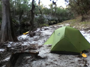
| Camp Day 4 |
29th October 2012. Day 4. 20.8 miles.
Awake and moving at 07:00 and after packing up camp, carried my gear to the put in point and then wheeled Gretel the
220 yards or so down there as well. I loaded her and lowered her down the bank/cliff at about 60 degrees into the
water. The stern went in a long way before the bow arrived. I then climbed through some debris and a small creek
and walked her a little way downstream and boarded without difficulty at a tiny sandy ledge. I was underway at 09:30
which was sooner than I had expected. It was a relief to be on the river rather than lugging things around on land. I
had a head wind. It didn't matter which way the river meandered around, I had bullets of 20 to 25 kts always on the
nose. So it was a slower and harder day, putting down at 16:00 having found a sandbank to camp on. Little Shoals
were straightforward, but there were a number of places where large trees adrift in the river had grounded, and you had to
find your way through. I got hung up on one and had to rock and push over it. I stopped at the Stephen C.
Foster State Park around noon, the one in Florida this time, and got water. There is a tap at the base of the shower
at the top of the stairs, only about 50 yards up the path from the boat ramp. So a harder day, but I am glad to have
the portage behind me. When you first look at where you have to get out and then back in it looks very difficult, but
it went well.
28th October 2012. Day 3. 21.7 miles.
A good current over rocky shoals as I set out but it dwindled away to almost nothing later in the day making it a bit of a
slog. They are correct: you can hear Big Shoals before you see them. You see them late, and only about 10
yards before the first of them, on the left bank, is a red traffic "Stop" sign to indicate the haul out place for
the portage. The shore there is steep-to, and I managed to fall in, of course, while getting out. After a full
day with little leg movement, some stiffness and uncoordination is allowed I think. The soft mud into which my leg sank
did not help either. I unloaded everything at the water's edge, dragged Gretel up the 10 foot clay and rock cliff, fitted
the wheels, and towed her down about 150 yards to the excellent camp site immediately above the shoals. The sound of
the water over them was nice. I took a look at the recommended put-in but with the lower water level it would mean
crossing an exposed bar or paddling like hell for the far side of the river. In any event it was an impossible place
to lower the kayak and then board her, so I took a look at another 200 yards further downstream which is better, but
not much. The day was clear, with a rising Northerly wind, but every time there was a strong wind, it always came from
ahead, no matter what the clouds above were doing. A bit wearing. I saw a dead wild pig strung up in a tree yesterday,
alerted to its presence by the smell - so don't drink the water!
|
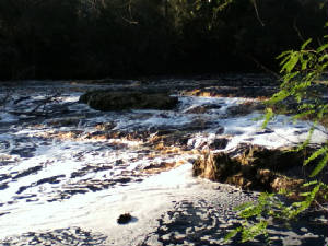
| Big Shoals |
|
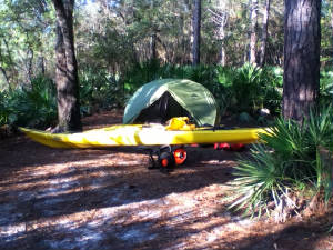
| Camp at Big Shoals |
27th October 2012. Day 2. 23.8 miles.
On the water by 09:10 after filling up with water after a short paddle to the blue building beside the bridge. The faucet
is at the back, and I managed to get out, walk there (I knew it from my reconaissance) and board again without falling in
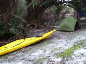
or out. The current was OK to start with but dwindled to a quarter knot by the end of the day. Another hardish
day paddling nearly all the time, and I camped on a nice sandy ledge beside a boat ramp (marked as a canoe launch) about
16:20. It was a small but nice site. Water may be an issue. I had thought it was available at Big Shoals
but apparently not. Few mosquitoes and again an early night. It is dark a bit after 19:00 so there is little
point in staying up much past then.

|
| View Upstream from Camp Day 2 |
|
| Camp Day 2 |
26th October 2012. Day 1. 21.5 miles.
I was underway by 09:30, a little later than I would have liked but it did not get light until 07:20, which was a surprise
and it took two trips of about a quarter mile to take all the gear down to the kayak, and then time to load her. The
weather was humid with moderate wind and scud as Sandy moved up the east coast. Although not brilliantly marked,
by following the sign, and the current, I found my way to the River Narrows, which were indeed narrow. At times it was
like something out of The African Queen with the paddle brushing the long grass on either side of the narrow stream of water. But
again, "follow the current" became my mantra and worked out all right, even when later on the stream passed
through flooded swampy areas. The river was at 52.8 feet (at White Springs) and I found it easy enough to paddle
over the Sill that backs the swamp up, although the rudder hit the concrete ledge just under water. At lower or higher
levels portage might be required, as everyone kept telling me. There is apparently some rule about this. There
is one spillway gate open on the right, and it looked reasonable to try it and it was. The swamp itself and the Narrows
were bird city: many, many of them roosting. The tree roots were remarkable the way they intertwined down to the
water, looking like a nest of anacondas more than anything else. I had had enough about a mile short of arriving at
Fargo (Georgia) at 16:00, even though it looked like half to three quarters of a knot of current, which I appreciated.
I camped on a sand bar near the bridge. When I unpacked the tent, I found several hundred (true) mostly dead mosquitoes
inside. I had left it open after getting up and having breakfast - a mistake. I was in bed early.
25th October 2012. I arrived at the Live Oak
Canoe Outpost about 14:30 and by 16:00 Dave had ferried Gretel (my kayak) and myself to the Stephen C. Foster State Park in
Georgia at the southern end of the Okefenokee swamp. I made camp there, positioned the kayak at the boat ramp, ate,
slept, and was bitten by a zillion mosquitoes while doing so. I am used to having to wave your hand across your food
while tranporting it to your mouth, but only for bush flies. Never before for mosquitoes.
18th October 2012 I thought I might try
kayaking again, but this time with some current. The intention is to put in at the Stephen C. Foster State Park at the
South end of the Okefenokee swamp in Georgia, and then follow the Suwannee River which originates there, down to the Gulf
of Mexico at Suwannee, some 242 miles.
I intend to camp in the Park next Thursday night (25th
October) and set off the following morning. The track should be available here via Spot, but I doubt I will have
internet access, so there will be no narrative until after the event. It might be a very short trip, if it proves
too much again, or very long if it is almost too much, but I estimate (optimistic as usual) that if it is just enough, I should
take about 15 days.
The general idea had been to buy a kayak and associated gear, do the
Anclote down and back as a preliminary way to see if the whole concept worked, and then kayak across Florida on the Okeechobee
Waterway to test equipment and load carrying with a view to the Missouri in May. Just as well I had these trial runs.
18th March 2012. 16 miles. And the
same again. The wind was behind me and while the day dragged it seemed easier going and I locked through at Ortona at
15:00. And there was no bloody boat ramp on the South side of the canal. I was forced to come alongside the rock
wall, and then transfer all the gear out and haul Gretel, with some scratching, up onto the grass at the top in the campground.
At this point I had had enough. As it turned out I had lost 7 pouinds in 5 days. I was too tired each day to eat
properly, the business of making and breaking camp (at which I am pretty slick - the gear is good and I have done it many
times) was tiresome, the kayak was heavy with all the gear, my knee did not help (it is still stuffed now on the 25th and
may need flushing out again) and Diane was returning to Tarpon Springs via my location. I was simply not enjoying the
exercise: I could do it if I had to, but I did not have to. Accordingly Gretel was loaded onto the truck at 18:30
(after I had enjoyed a pleasant nap on the grass) and we went home, after 100 or so miles in 5 days. It was a fair effort,
but effort it was. The logistics of water, food and camp were the biggest problem. I, accordingly,
think that the Missouri was a noble idea, but just too bloody hard to contemplate on my own. And that was the reason
for the trial run, fully laden in still water. To find out how hard it was going to be. The answer was, too hard.
17th March 2012. 20 miles. Again I was
up shortly after 07:00 and away by 08:30, also again without breakfast. At this stage I was not enjoying the required
effort, nor the handicap my knee was representing so aimed for Moore Haven and the lock there to leave me with a lesser run
to the next lock at Ortona. So I pushed along a little harder than before. After the initial stiffness in the
shoulders wore off it was not too bad. I made Clewiston by 12:30 and then Moore Haven by 16:00. There were many,
many alligators again. At one point there were four pairs of eyes gazing at me in line abeam on my startboard side in
20 yards. The lockmaster was not too sure about letting a kayak through but I explained the attitude of the one I had
consulted back in December at Ortona and I paddled on through. I turned left at a boat ramp and after begging water
from a mobile home park (very polite and the water was cold) I again made camp at last light on the edge of the canal and
slept well. Since it was a public boat ramp I had fitted the wheels to Gretel and had hauled her beside me at camp.
They worked very well.
16th March 2012. 22 miles. There had been
a massive dew overnight and everything was dripping. No breakfast after a 07:00 rise and, with the ferrying of gear
back to the kayak over a boulder sea-wall it was 08:15 before I was underway. I am now in a position to definitely state
that the Florida alligator is not endangered. I saw hundreds. The ones sunning themselves suddenly realized my
presence and make a huge crashing and flurry as they got to the water leaving a large bow wave. They then, almost invariably,
surface about 5 seconds later to see what's going on, and often surfaced right beside me, and in surprise thrashed away.
Those already in the water, would just slowly sink. First body, then nostrils and finally the eyes that had been coldly
regarding you. I stopped
in at Slim's Fishing Camp for water and as very carefully easing my body up onto the dock and trying not to fall in, a large
snake slithered across the deck at the base of the dock and into the water. A surprise. Happiness is having full
water bottles, however, and I paddled on around the South end of the lake finally stopping about 8 miles short of Clewiston
and again having to negotiate the sea-wall to locate and make camp. I had a can of luncheon meat for dinner. I
was just perched on the side of the lake and left it until close to last light to put up the tent to avoid inquisitive eyes,
and I just made it inside as the mosquitoes struck. They coated the mesh of the tent, but again I was asleep before
20:00. At this point the whole concept was starting to become suspect. Nine hours paddling, virtually non-stop,
is hard work, and the logistics of camping out each night were also starting to wear.
15th March 2012. 16 miles. I was awake
by 08:30 but again could not bring myself to cook or eat. It took the same number of difficult trips to carry the gear
back to the kayak and stow it all again. In the process I managed to tweak my suspect left knee quite badly and it was
not until 10:30 that I actually got onto the canal again. After the chore of breaking camp, it was almost restful.
The Fort Mayaca lock had both gates open and I paddled straight through into Lake Okeechobee about 12:30. There
was a moderate squall at the time and as I turned South to follow the shore, it blew up strongly from dead ahead and I had
an hour or so of very hard paddling into it. It rained heavily. I finally found a spot to haul out on the shore
just before 17:00, but again there were multiple trips required to take the camping gear up over an expanse of large rocks
to the flat area I could camp on. This was a recreation area, closed due to the work raising the levy and
apart from the earth-moving equipment working all night nearby, again I slept as if shot. It was only 16 miles but after
the previous day, and the head winds, it was more than enough. I managed a can of tinned sausages and a small can of
fruit and again was asleep by 20:00.
14th March 2012. 26 miles. I put
in at the public boat ramp in downtown Stuart at 07:50. The previous hour had been spent trying to pack all of the required
gear into a 17 foot kayak. I nearly got it all in, but it reminded me of trying to stow provisions prior to a passage.
It never looks possible when you start. One small dry sack had to be stowed on deck in the end, along with the frame
for the wheels. The first lesson learned (as with bicycling) was that paddling a fully laden kayak is very different
from paddling an empty one. Bloody hard going, especially to get moving in the first place. I had a slight ebb
tide against me until the St. Lucie lock and this did not help. Locking through was a non-event and the lockmaster
was great. Later in the afternoon I found that I was "trapped" on the canal, the steep banks on either side
precluding hauling out. It was not until nearly 19:00 that I found a small swamp off to the side and was able to get
ashore. I made camp in a friendly gentleman's back lot, next to the swamp, after multiple trips up a rocky, gravelly,
brushy bank of 10 or 15 feet. I was warned of the 12 foot gator in the swamp and kept waking up at night when
he grunted, trying to gauge if he was getting closer. After the multiple climbs, and 11 hours of more or less constant
paddling, I was totally stuffed. I could not face cooking a meal, or even eating anything, and after setting
up camp was asleep in my tent by 20:00. Exhausted.
8th March 2012 Her name is Gretel. I started from the Perrine Ranch Road bridge over the Anclote river at 09:40
and paddled down to the park at the mouth of the river and then back again, returning at 16:50. It was 17 miles but
against the current both ways. The tides were at springs and the timing exactly wrong but it was the only day for a
trial run. Under two of the bridges I had to paddle flat out just to get through, the current was sufficiently strong
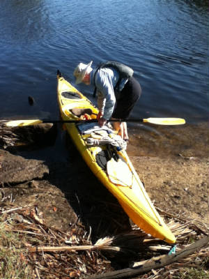
there. For my trouble, two blisters (despite being a wimp and wearing gloves) and I fell in while trying to get out
of the kayak at the end. Twice. This skill needs a little work.
I intend to put in a Stuart on the East coast of Florida Wednesday morning, and see how far I can get toward home.
The track should appear on this web site, as before when bicycling.
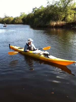
7th March 2012. I bought a kayak today,
a 17 foot Necky Looksha IV. It is a second hand demo one from Bill Jackson. I am not sure of her name yet, but
I am sure she will let me know.
|
| Trying to Paddle |
|
| Trying to Board |
|